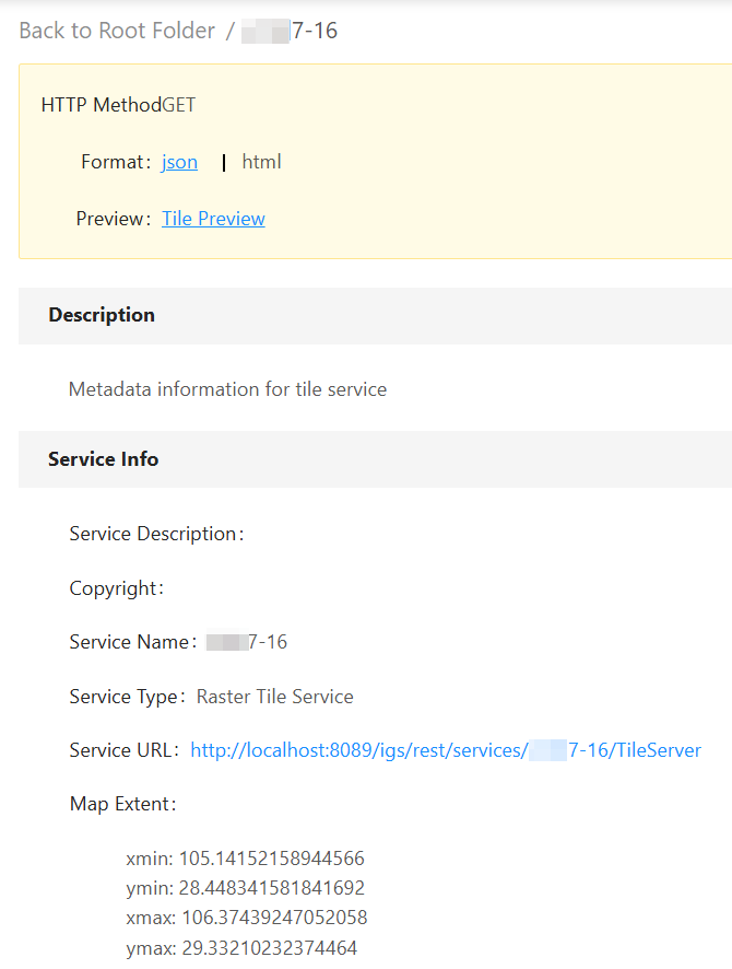
Tile service
Publish service
 Function Description
This feature allows you to publish MapGIS Tile, ArcGIS Tile, and raster tile folders as MapGIS standard tile services.
Tips:
When publishing a service, you can only select the corresponding files in the registered folder. See " Folder " for detailed steps.
 Operating Instructions
1. On the Service Management page, click " Publish Service " - " 2D Map Services " - " Tile Service " to launch the Tile Service Publishing page;
2. Set Basic Information, you can set the following information:
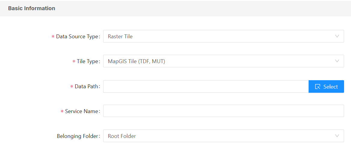
- [Data Source Type]: You can choose from twelve data sources, including raster tiles, raster tile folders, raster tile MongoDB batch data, raster tile MongoDB batch data (Excel), raster tile PostgresQL batch data, raster tile PostgresQL batch data (Excel), WMTS service, Tianditu service, Baidu Map service, Bing Map service, OSM map service, and DataStore Mongo tiles.
- Raster tiles include seven types: MapGIS Tile (TDF, MUT), MapGIS Tile (MongoDB), MapGIS Tile (GPKG), MapGIS Tile (MBTILES), ArcGIS Tile (loose), ArcGIS Tile (compact), and ArcGIS Tile (TPK).
- Raster tile folder: A folder that stores raster tile data;
- WMTS Service: OGC Standard WMTS Service;
- Tianditu Service: Tianditu online service, including various map services such as vector base maps, vector annotations, and image base maps.
- Baidu Maps Service: Baidu Online Maps;
- Bing Maps Service: Bing Online Maps;
- OSM Map Service: OSM Online Maps;
- DataStore Mongo tiles: Raster tiles stored in the MongoDB data source of DataStore big data.
Tips:
When using online maps, it is essential to ensure that the IGServer can access the map service normally, and some map services require a security key.
- [Data Path]: Select the storage path of the data source on the server (for MongoDB, you need to fill in the data source address, database name, username and password);
- [Service Name]: Sets the name of the current service;
- [Owned Folder]: Sets the folder to which the current service belongs;
- [Enable Tile Encryption]: Allows you to set an encryption algorithm for the raster tile service, including SM4 and AES. After encryption, the frontend needs to decrypt the tile when calling the service. See " Map Services " for details.
3. You can choose to enable the watermark. After enabling and customizing the watermark, the watermark style will appear in the published map preview.
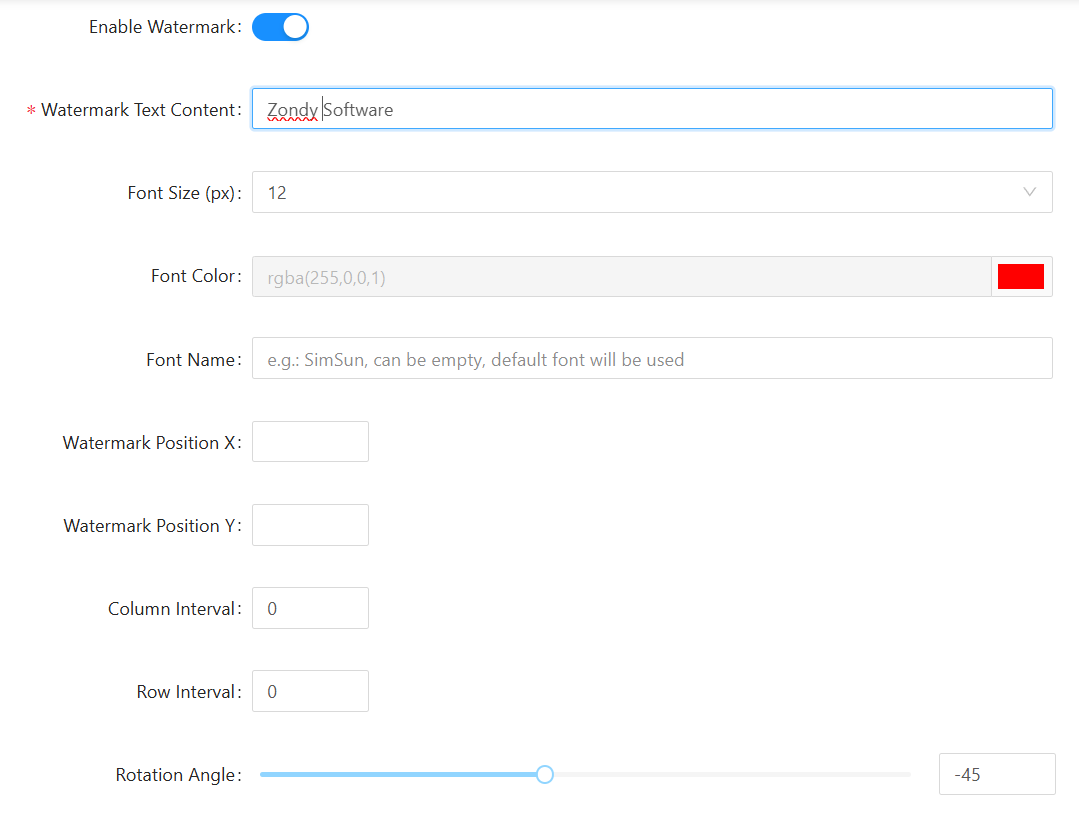
- [Watermark Text Content]: You can enter any text content;
- [Font Size]: Customize the size of the watermark text content;
- [Font Color]: Customize the display color of the watermark text content;
- [Watermark Position X]: Customizes the display position of the watermark text content, which is the X coordinate of the top left corner. It can also be left empty to center the watermark.
- [Watermark Position y]: Customizes the display position of the watermark text content, which is the Y-coordinate of the top left corner. It can also be left empty to center the watermark.
- [Line Spacing]: Set the distance between watermark text content based on the width of the tile grid;
- [Column Spacing]: Sets the distance between watermark text content based on the height of the tile grid;
- [Rotation Angle]: Sets the angle at which the watermark text content is displayed, -360°~360°, the default is -45°;
Tips:
After configuring the watermark parameters and publishing the service preview, if you need to modify the watermark parameters, you must clear your browser cache for the changes to take effect.
4. Perform service configuration. You can enable the WMTS service/OGC API -Tiles in the " Service Configuration " section:
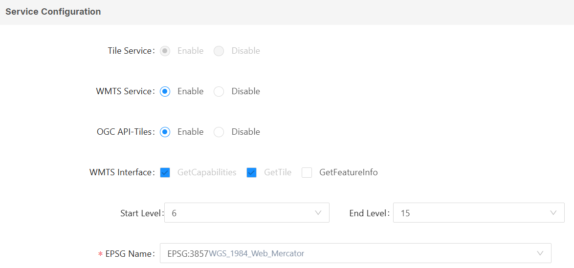
- [WMTS Interface]: Enable WMTS interface service support for the published tile data, and select the WMTS interface types supported by the published service;
- [OGC API-Tiles]: Enables OGC API - Tiles interface service support for published tile data;
- [Crop Levels]: Set the number of cropping levels for the tiles, depending on the application requirements;
- [EPSG Name]: Click the drop-down box to the right of the EPSG name and select the correct map reference system;
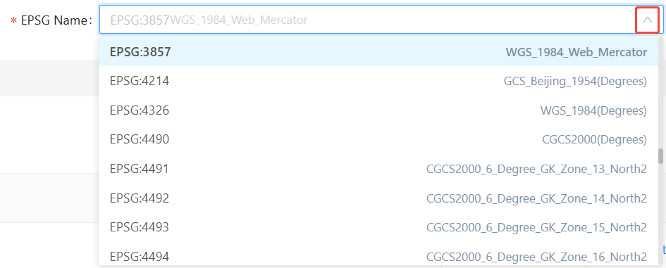
- [Map Service]: When the "GetFeatureInfo" interface is selected under " WMTS Interface ", you need to select a map service to access from the drop-down menu;
5. Access permissions for the service can be set in the " Security Settings ". For details, please refer to the " Permission Settings " section of the 2D map service.
6. Click the " Publish Service " button to publish the current tile service.
Service Details
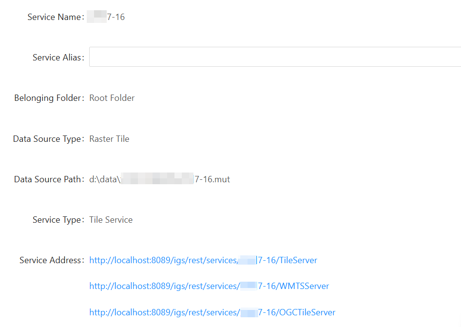
After publishing a tile service, you can view the service information and edit the service parameters through the service details.
Preview service
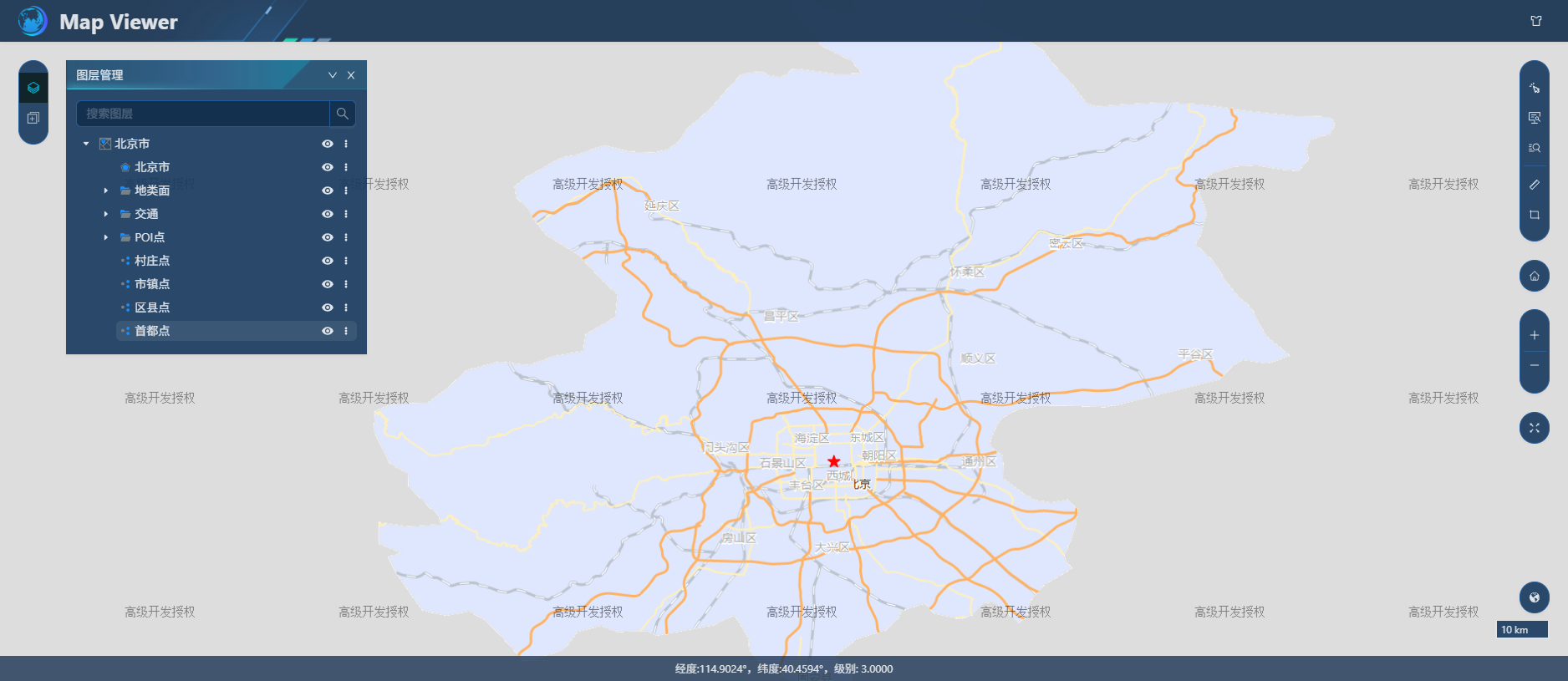
1. After successfully publishing the tile service, the page will return to the service list. Click the " Preview " button to the right of the current service to enter the Map Viewer page. For detailed instructions, please refer to " Service Preview ".
2. After successfully publishing the tile service, click to enter the service details page, and then click the service address of the tile service to view the tile service base address page.