Pickup query
Pick up
 Function description
The picked up layer will be highlighted and displayed in the form of a popup box to display the attribute details of the layer.
 Operating instructions
1. Click "Preview" - "Map Service" to enter the "Map Viewer" preview interface.
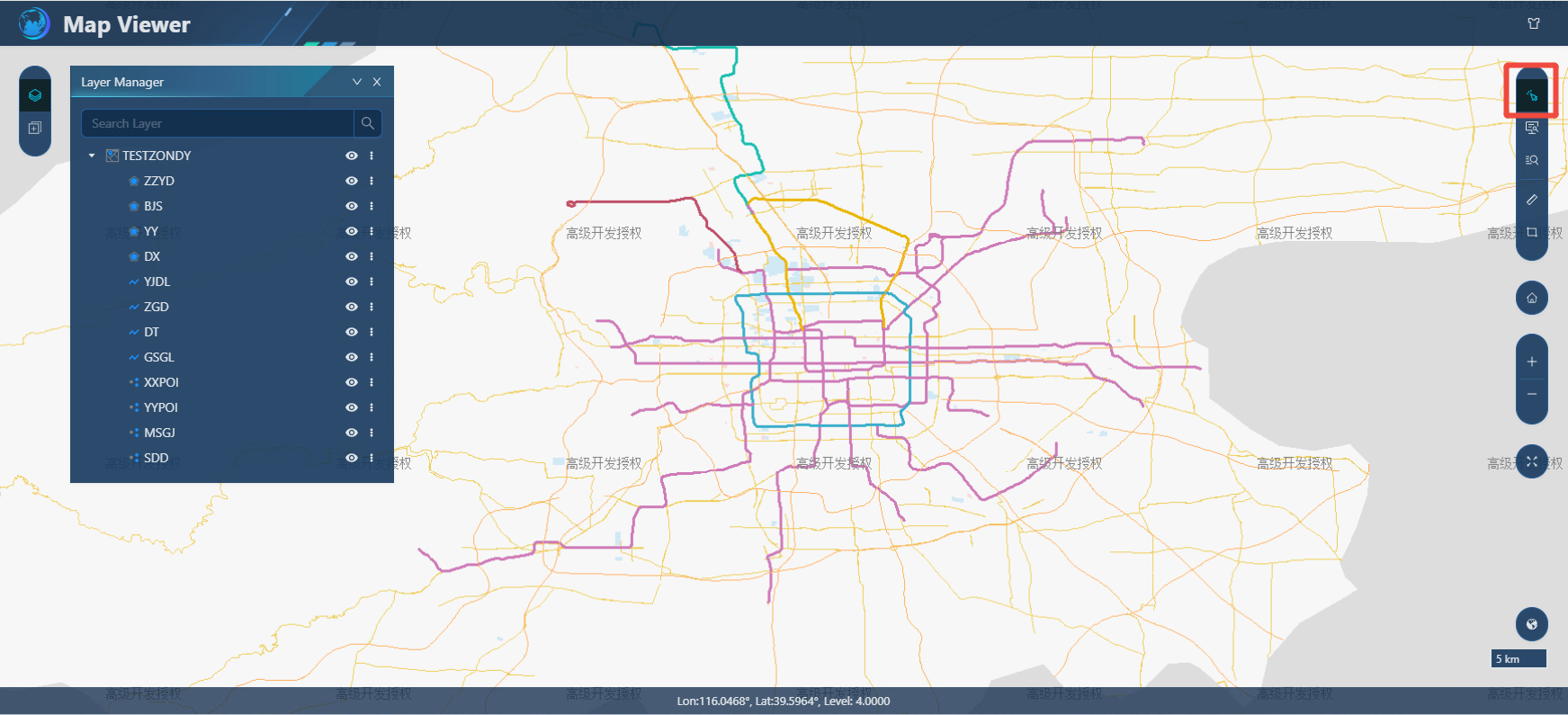
2. Select the "Pickup" button, pick up the layer with the left mouse key, the picked layer will be highlighted, and the attribute box will pop up, as shown in the figure below:
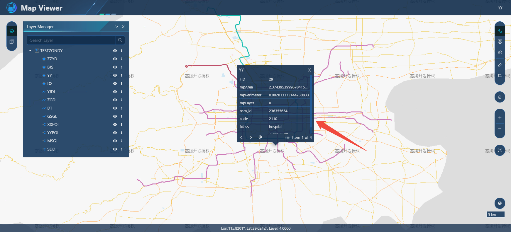
3. On the attribute box, you can display the attribute content of multiple layers that have been picked up by turning the page, and you can also use the "Zoom to" button to position the picked up elements.
Feature query
Function description
Feature query is an interactive feature query function that allows users to query queryable services in different interactive ways and display the query results in the form of attribute tables. Based on the query results, you can edit attribute information and other functions.
Operating instructions
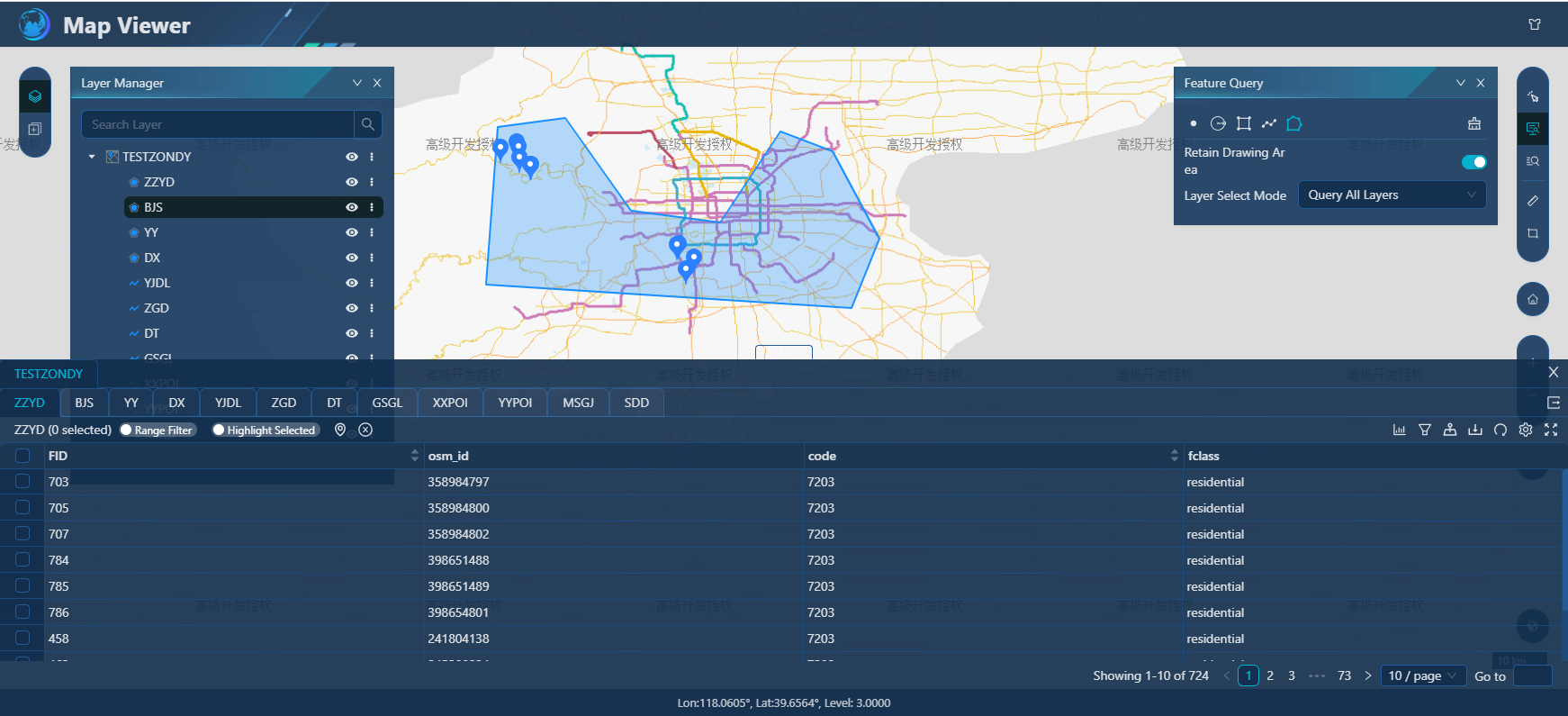
1. Click "Preview" - "Map Service" to enter the "Map Viewer" preview interface. Select the Feature Query button to pop up the Feature Query toolbar, as shown in the following figure:
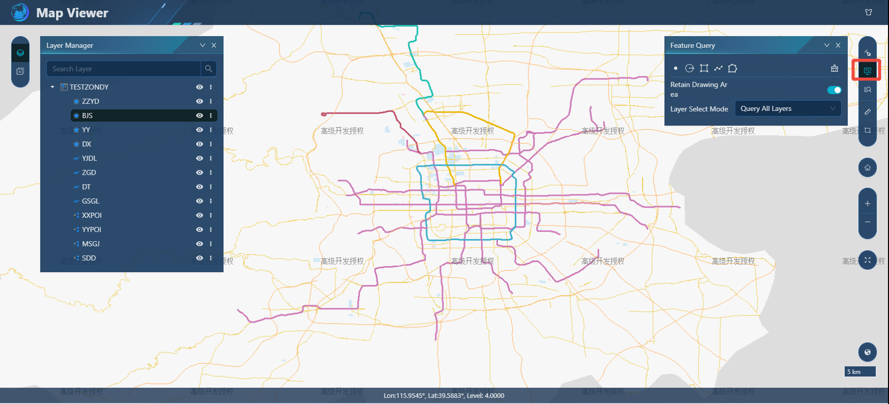
2. When you open "Retain Drawing Area", you can keep the drawn query area, and vice versa.
3. Layer selection mode, you can choose "Query All Layers", and the query result set displays all the layer attributes that have been queried; You can also select "Query Selected Layer", after checking the specified layer, the query result set will only display the specified layer attributes that are queried.
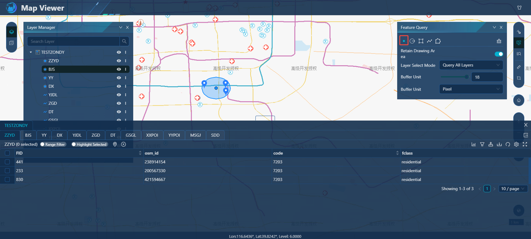
- When using "point" to query features, you can interactively click the coordinates with the left mouse button in the view, you can query the features within the specified buffer radius, and you can set the cache distance and buffer unit.
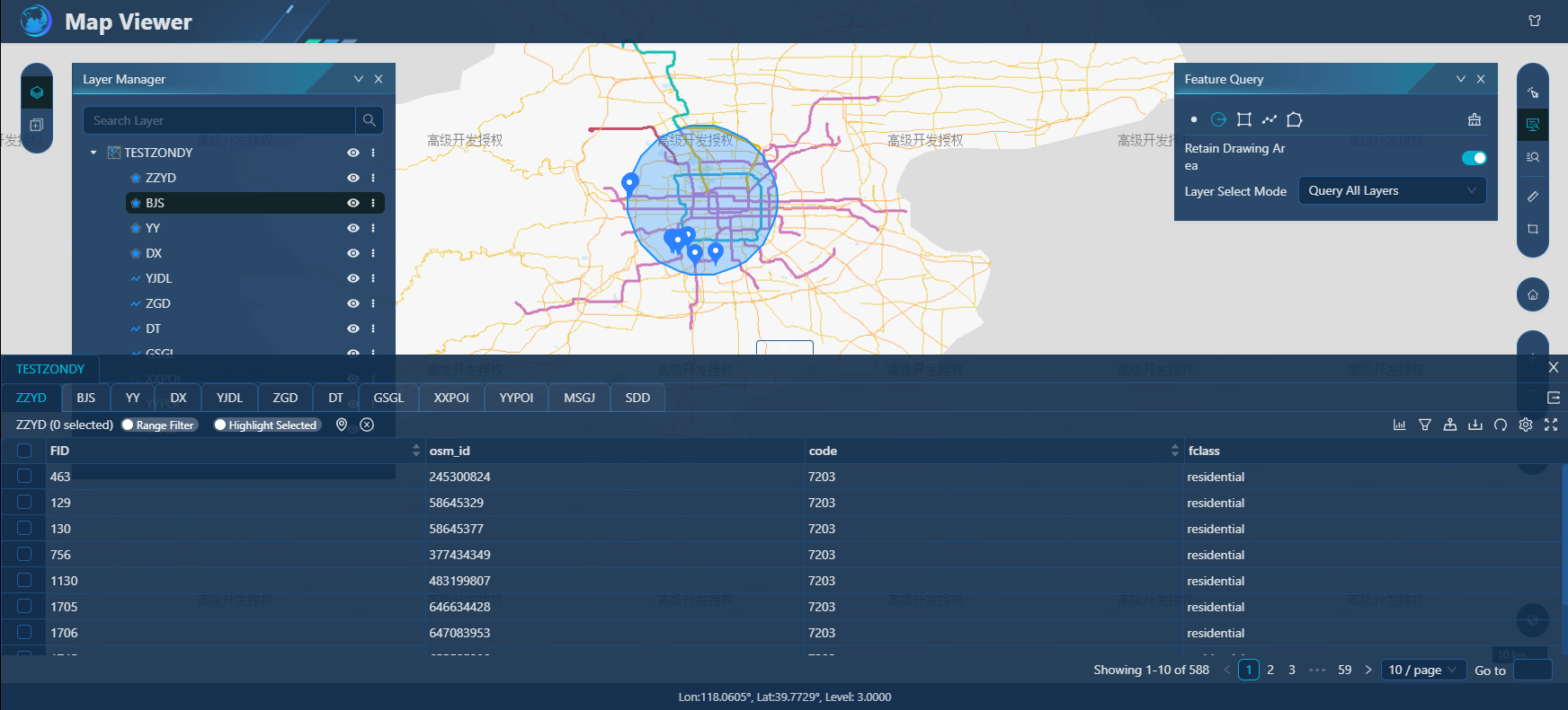
- When using "circle" to query features, you can enter a point as the center of the circle by left-clicking the left mouse button in the view, and then enter the point to determine the radius of the circle to query the features within the circle.
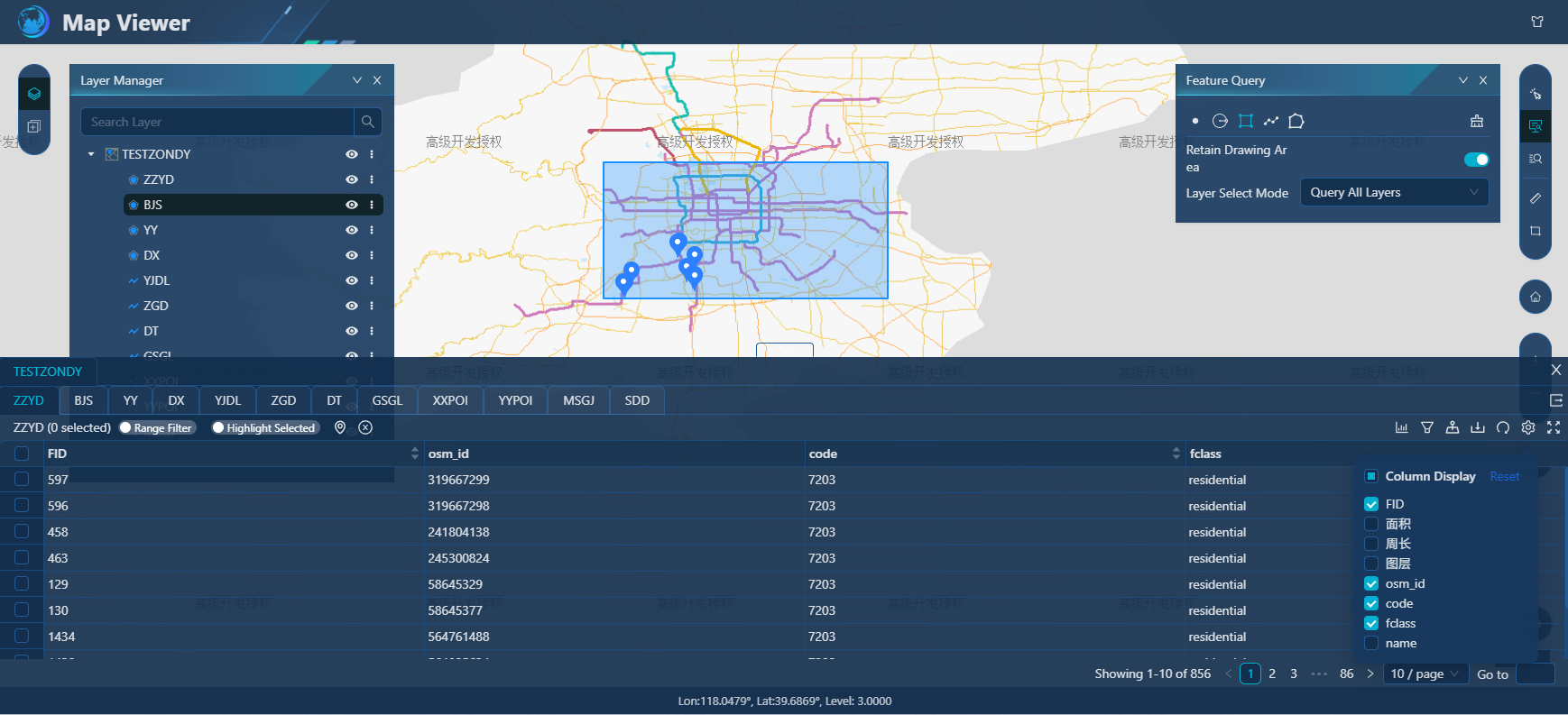
- Rectangular query, when using "rectangle" to query features, you can enter two points as two diagonal points of the rectangle in turn with the mouse in the view, and you can query the features within the rectangle.
- When using "line" to query features, you can interactively input line nodes with the left mouse button in the view, you can query the features within the specified line buffer radius, and you can set the cache distance and buffer unit.
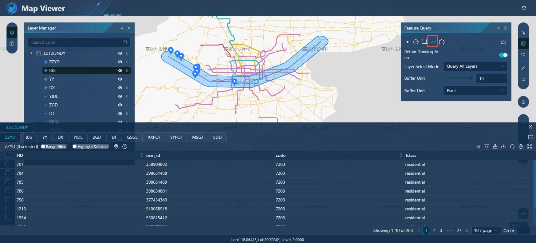
- When using Polygon to query features, you can use the left mouse button to interact with the boundary point of the input area in the view, and the left mouse button double-clicks to end. You can query features within the polygon range.
Attribute query
Function description
Attribute query is a function that allows users to query service layers with different query conditions according to their needs, and display the query results in the form of attribute tables. Based on the query results, you can edit attribute information and other functions.
Operating instructions
1. Click "Preview" - "Map Service" to enter the "Map Viewer" preview interface. Select the Attribute Query button to pop up the Attribute Query tool, as shown in the following figure:
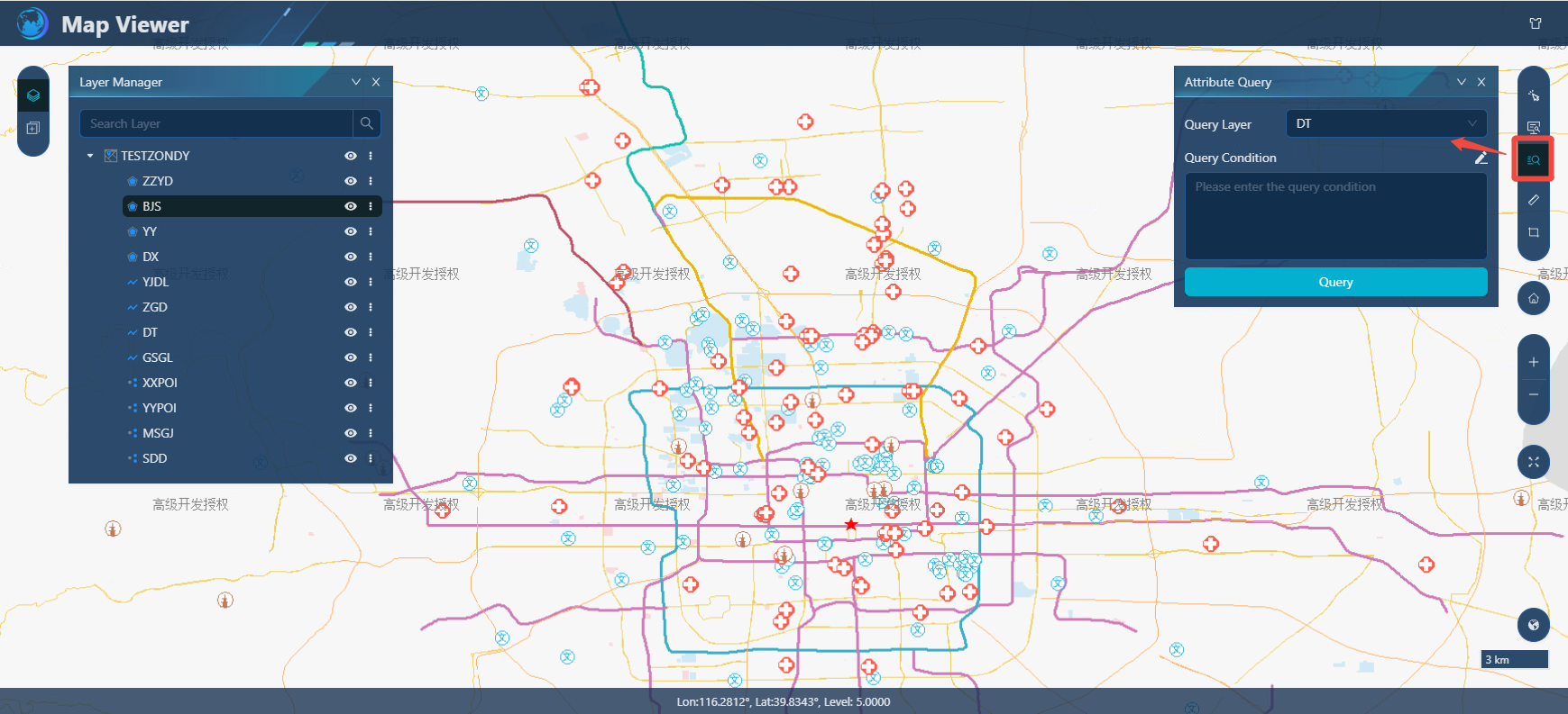
2. Query layers, specify the layers that can be queried in the drop-down box, and activate the "Query" button after selection.
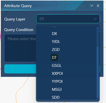
3. You can directly click "Query" to pop up the attribute table to query all the attribute information of this layer.
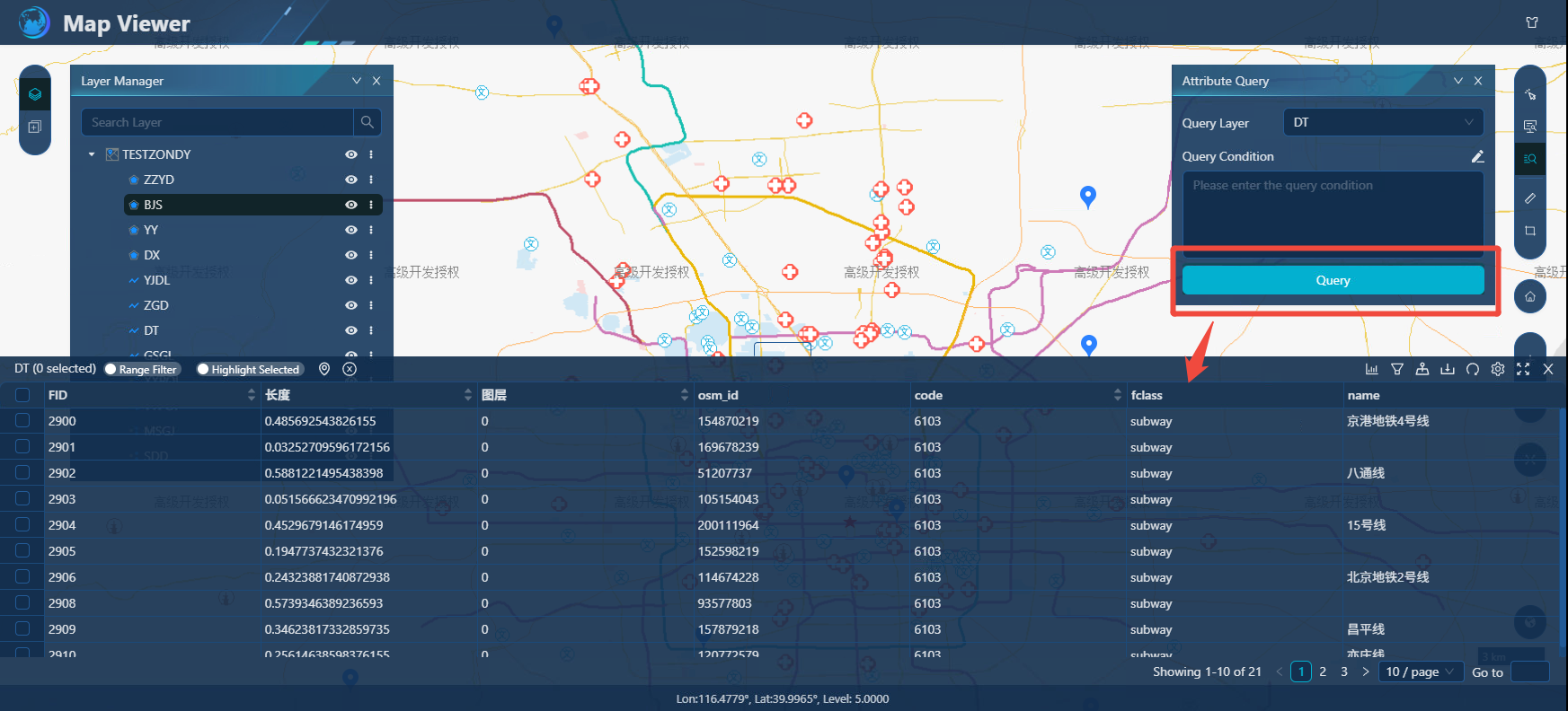
4. Custom query is also supported, users can select the field as needed through the custom query panel, and the attribute value after the field is deduplicated will be displayed in the field information box, and then with the "operator" panel, select the field, field value, operator by mouse click, combine into a standardized GSQL conditional statement, and then click "OK" to query. For users who are familiar with GSQL, you can manually enter it in the Enter Query Criteria box. Querying for eligible results will be displayed in the Result Set panel.
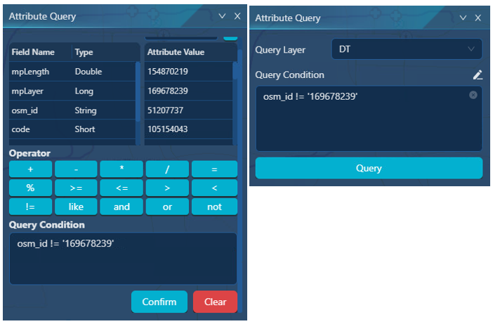
Query result set
Function description
Result set query results can be linked to views. As shown in the figure. Query functions such as feature query, property viewing, and custom query are all displayed in the result set mode by default.
Operating instructions
1. Click "Preview" - "Map Service" to enter the "Map Viewer" preview interface. Select the "Property Query" button, select a layer, click Query Properties, and the layer property results will be displayed in the bottom result set, as shown in the following figure:
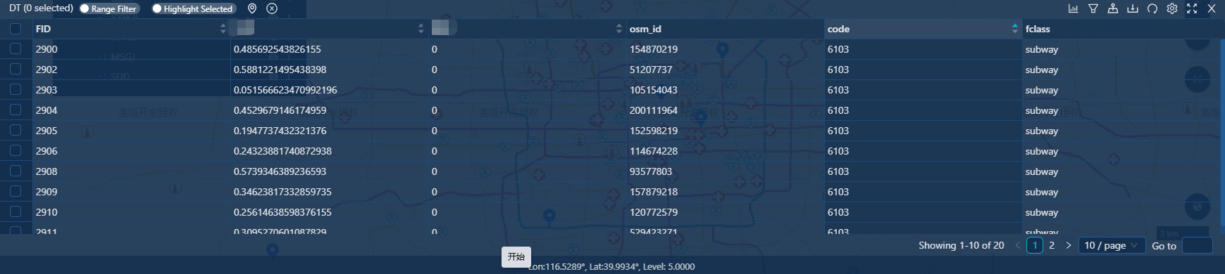
2. Introduction and application of functional parameters of the result set.
[Range filtering]: is turned off by default, and when turned on, the result set queries and displays only the current screen range result set, and marks it in the view.
[Highlighting Selected]: is off by default, and when turned on, the result set checks the feature, jumps to the current view, and highlights the selected feature.
[Locate to]: Click the attribute row to locate the view to the selected feature range.
[Clear Selection]: Clears all selections in the attribute table and dehighlights them in the view;
[Check]: Perform the check operation by checking the box in front of the table attribute row of the result set.
[Full Screen]: The result set view can display the application in full screen;
[Refresh]: To update the display results of the current attribute table;
[Export]: Export the result set to a local CSV or Json file.
[Column configuration]: You can customize the visible/invisible fields in the result set.
[Annotation Model]: View supports two forms of annotation, feature highlighting, and more.
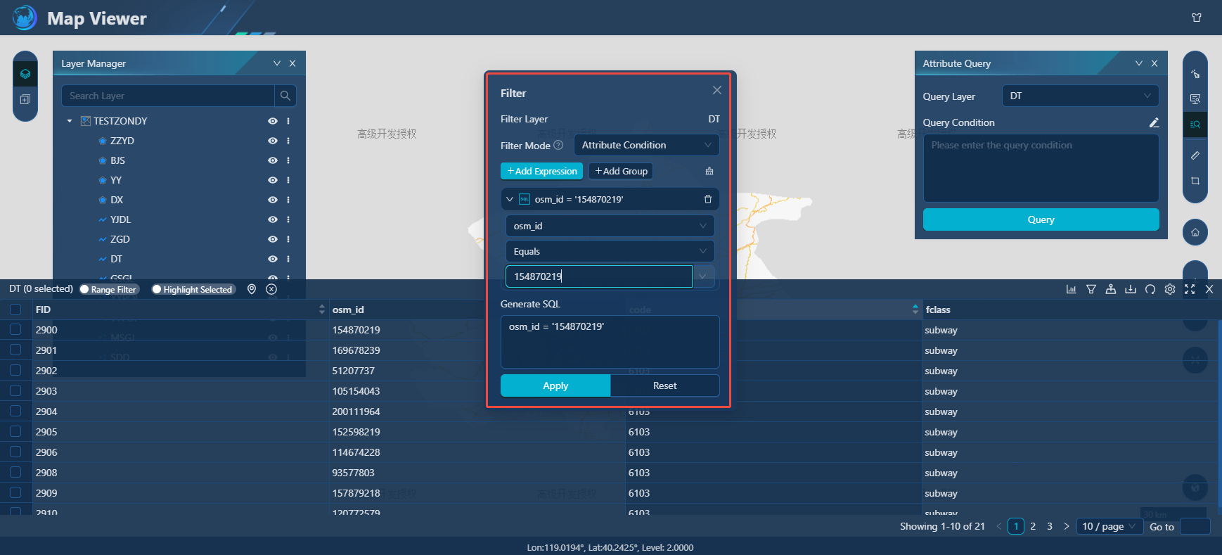
[Filter]: Attribute Filtering displays the result set according to the filter conditions through SQL statements. As shown in the figure, the results will be filtered and displayed according to the set conditions, supporting conditions such as greater than, less than, equal to, not equal to, maximum for, minimum as, between, not between, empty, and not empty;
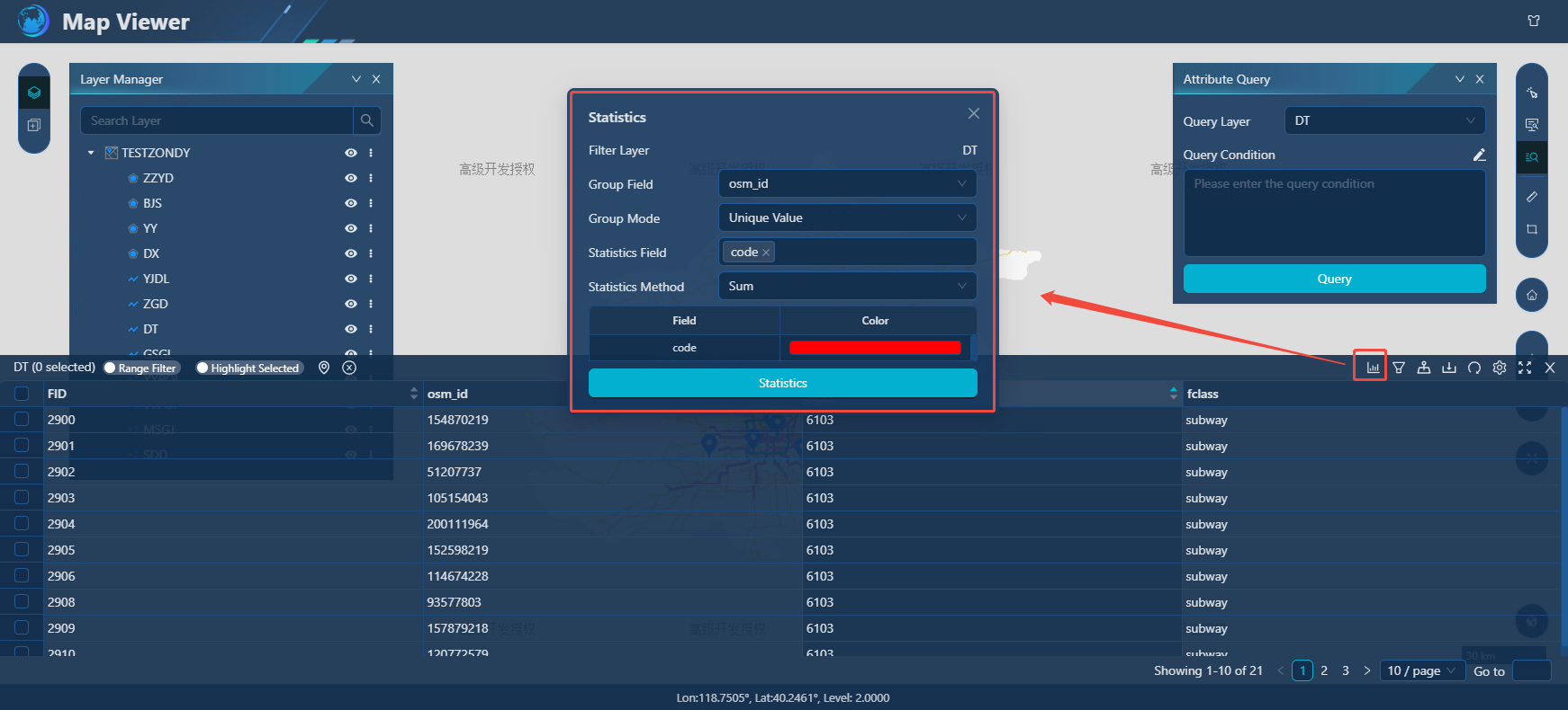
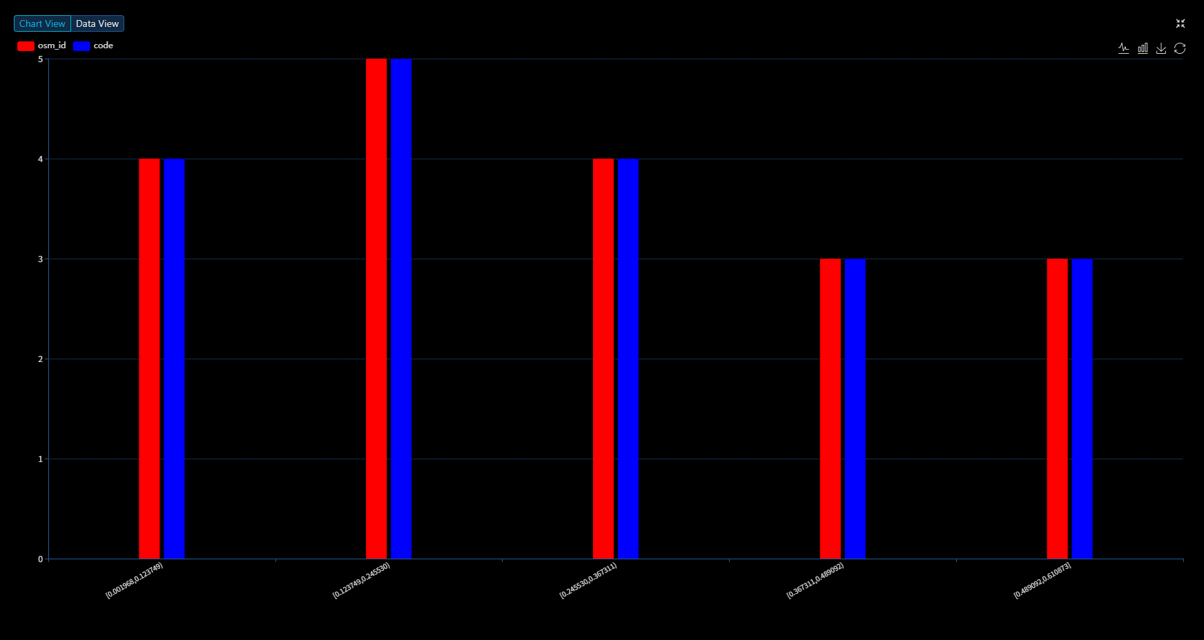
- Attribute statistics mainly perform mathematical statistical analysis on selected fields, including count, frequency, sum, maximum, minimum, average and variance.